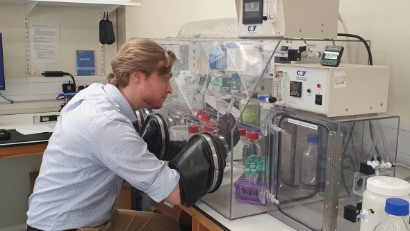
Research fellow Ben Davis Barnes creates minerals with simulated seawater at Cambridge University.
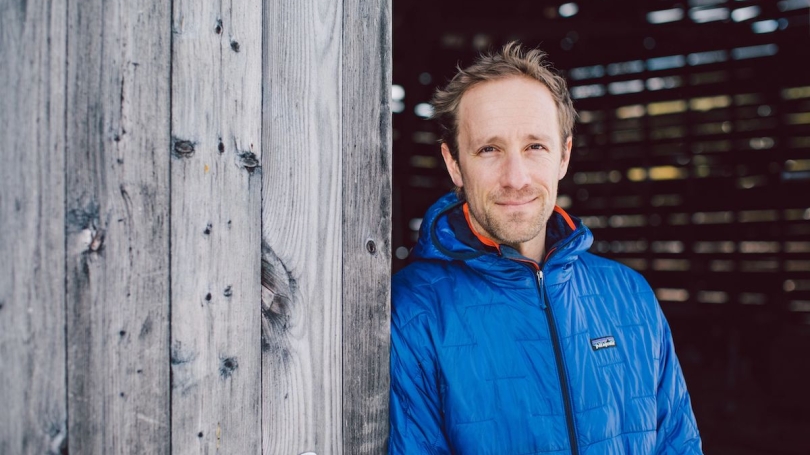
Associate Professor of Earth Sciences Justin Strauss leads innovative research that combines experiments in the lab with fieldwork around the world to reconstruct ancient environments.
Growing up in Ojai, Calif., Associate Professor of Earth Sciences Justin Strauss was captivated by the beauty of the coastal mountain ranges that surrounded him.
Ancient geologic forces shaped the modern-day Ojai Valley, whose mountains and valleys were moved by ancient faults into an east-west configuration—making it a particularly fitting hometown for Strauss, who leads research around the world that reconstructs ancient environments and sedimentary basins.
Among his research interests, Strauss studies carbonate rocks, formations of limestone and dolostone that reflect the ancient chemistry of oceans and other water bodies. In 2021, he was one of 128 researchers from the United States and Canada to receive the prestigious Sloan Research Fellowship. The grant supports Strauss in research on how marine carbonate production has changed over the course of Earth's history, particularly before the advent of biomineralization. Since carbonate rocks are the "long-term sink" for carbon dioxide in the atmosphere, the research provides insight into the planet's long-term climate history.
As part of this work, Strauss's research fellow Ben Davis Barnes is creating minerals with simulated seawater in a specialized lab at Cambridge University this year; insights from these experiments will be coupled with fieldwork this summer on two-billion-year-old rock exposures in the remote Northwest Territories and Yukon of northern Canada.
"Our research will inform how carbonate rocks are formed and give us a fascinating window into our understanding of the ancient world," Barnes says. "The better we understand these enigmatic structures, the more we can understand how the Earth evolved and what the future ocean environment will look like in the face of global warming."
In a Q&A, Strauss reflects on his calling to "read the rocks," current research projects, and the stories behind some of the spectacular photos on his website.
What inspired you to focus your research on reconstructing Earth's ancient history?
Growing up in Ojai, I was surrounded by spectacular mountainous exposures of Cenozoic deep-marine sedimentary rocks. In middle school, when I found out these were once deposited on the deep ocean floor, I was in awe and wanted to learn more, but it was not until I attended Colorado College that I was able to dive in during my first geology science course. Fortunately, I had a wonderful professor, Paul Myrow, who inspired me to shift from pre-med to geology, and after that there was no question in my mind about studying the deep history of our planet.
Although I initially considered other subdisciplines within the Earth sciences, such as hydrology, I was always drawn to the sedimentary record because you can literally read the rocks to reconstruct ancient environments, something that I still feel is remarkable to this day.
What current research project are you most excited about?
This is a tough question. I have so many exciting active projects going on throughout the world. I am particularly excited about the research we are doing related to the Sloan Fellowship. Essentially, we are trying to couple observations we can make in the field about the texture and composition of ancient carbonate rocks with experiments in the laboratory to understand how the composition of seawater has changed over geologic time.
It turns out that Earth's long-term climate is intimately tied to the record of carbonate rocks because they form the largest sink for carbon dioxide over geological timescales, so the more we know about the carbonate rock record, the more we know about ancient climate. Due to delays related to COVID-19, we are just getting the next phase of this project going right now.
In your research you weave together myriad fields, including sedimentary geology, biogeochemistry, and computational geoscience. Why does this line of work require a multidisciplinary approach?
Earth science is by definition a blend of almost all of the physical and biological sciences—in fact, that is why I was so drawn to it in the first place. You must pull from all of these disciplines to understand the history and mechanisms of our planet, as well as the other planetary bodies in the solar system. As a result, if you want to test a hypothesis, it is very common to develop broad collaborations with other scientists from across the field, and other fields. Not only does this increase your exposure to other people and perspectives, but it also means you get to continually learn new things.
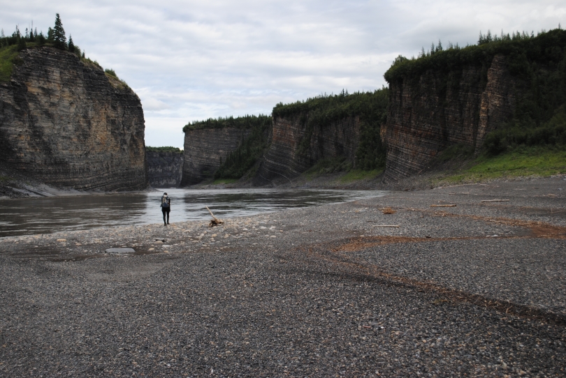
You have some spectacular photos of research sites around the world. What's happening in these two photos?
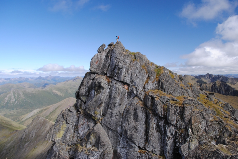
The first image shows my undergraduate senior thesis student, Peter Mamrol '16, who was conducting a thesis project examining volcanic rocks that erupted at the northwestern edge of North America approximately 500 million years ago. These rocks record the opening of the ancient Pacific Ocean, and it is part of a larger project that is still ongoing today focused on the tectonic development of the western edge of North America.
The second photo shows my first master of science student, Ginny Wala, on the Peel River of Yukon, Canada. That trip was in 2016, but we worked on this same exposure of rocks from 2015 to 2017. The goal of this research was to examine a single succession of sedimentary rocks deposited in a deep-marine environment that spans the entire early Paleozoic era, more than 380 million years ago. The idea was to do our best to constrain how oxygenated the water column was within this deep-water environment since our understanding of how oxygen concentrations have changed through geological history is still a major topic of debate. The results of this study were published in a recent Science Advances paper, where we proposed that oxygen slowly increased throughout this time interval but did not reach modern concentrations until quite late in the Paleozoic. This was contrary to many studies that suggested oxygen rose to near-modern levels at the end of the Neoproterozoic Era (associated with the Cambrian Radiation of animals).
Did you also study photography?
I did not study photography…it is just something I have picked up over the years. My wife always complains that all I do is take pictures of rocks, rock hammers, and landscapes.